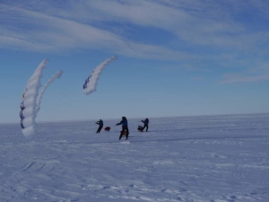
Sailing towards land!Yesterday we sighted land. That was South Victoria Land, in the southwest. Today we spotted more land. Tall mountains towering over the Ross Ice Shelf. This was new territory in 1911. No-one had ever seen these mountains before. Amundsen and his men had no idea what awaited them.
“Started our climb this morning. It began ESE ¼E. The dogs have done work today that has surpassed my greatest expectations.”– Amundsen on this day 100 years ago (Read more …) 
When it became known that Amundsen had taken up the race to the South Pole, many believed he would cut across the Ross Ice Shelf, below South Victoria Land, and ascend to the plateau by way of the Beardmore Glacier, taking the route Shackleton had discovered in 1908-9. But Amundsen insisted that this had never been his plan. Scott had declared that he would follow this route: “There is no question but that Scott’s route was reserved for him.” Amundsen’s route led due south. They would follow the compass and not veer aside. “The terrain must be very difficult indeed, if it is to prevent us from climbing up onto the plateau.” Now we ourselves are looking at this terrain, the mountains that bear the names of Amundsen’s benefactors Fridtjof Nansen and Don Pedro Christoffersen. We delight in this spectacle; we rejoice that the weather reports promise favourable winds. Today we sailed 54 kilometres. Position: S 83 33.392, W 163 52.929
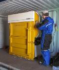
Temperature: -18°C Wind: 2-5 m/s from the southeast Distance traversed: 54 km Distance behind Amundsen: 194 km Did you know that littering is illegal in Antarctica?
The countries with activities in Antarctica have agreed that all waste produced during expeditions and at research stations must be sorted and shipped off the continent. |
South Pole 1911–2011 is an informational outreach project run by the Norwegian Polar Institute
Contact person:


