Gravneset in Magdalenefjorden
[79° 30' N 11° 00' E]
By Øystein Overrein (ed.), Jørn Henriksen, Bjørn Fossli Johansen, Kristin Prestvold
Gravneset (Grave headland) is surrounded by majestic mountains, tall glaciers and a magnificent nature in one of the most beautiful fjords in Svalbard. It is also where one of the largest cemeteries can be found, dating from the whaling period and consisting of 130 graves. The funerals took place over a period of almost 200 years, with the earliest graves dating from the early 1600s and the more recent ones dating from the late 1700s. On the beach by the cemetery there are four blubber ovens. It is not permitted to walk within the burial ground, which is fenced off, nor close to the blubber ovens.
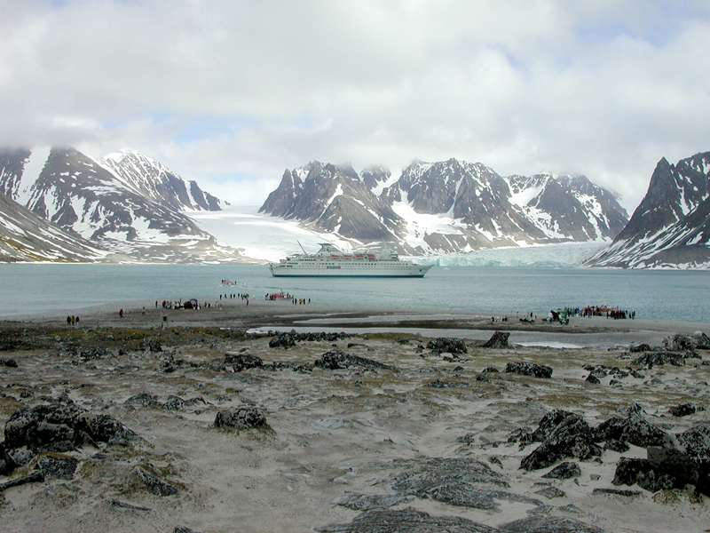 Alighting from cruise ships. Gravneset in Magdalenefjorden is the place in Svalbard which, apart from residential areas, attracts most visitors. (Image: Kristin Prestvold / The Governor of Svalbard) Take care:
- Do not go within the fenced off area of the cemetery.
- Do not go within the fenced off area around the blubber ovens.
- Do not walk on areas rich in vegetation.
- Do not disturb nesting birds.
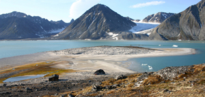 Overview of Gravneset. The fenced grave area is on the hill seen midway on the headland. The beach on the righthand side on the headland is the most popular landing site. Two of the blubber ovens are on the sandy beach in the middle of the picture. The green field to the left is moss tundra, which is vulnerable and must not be walked on. The Governor of Svalbard’s cabin for supervision is seen in the front. (Image: Bjørn Fossli Johansen / The Norwegian Polar Institute) Overview of Gravneset. The fenced grave area is on the hill seen midway on the headland. The beach on the righthand side on the headland is the most popular landing site. Two of the blubber ovens are on the sandy beach in the middle of the picture. The green field to the left is moss tundra, which is vulnerable and must not be walked on. The Governor of Svalbard’s cabin for supervision is seen in the front. (Image: Bjørn Fossli Johansen / The Norwegian Polar Institute)
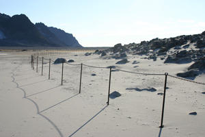 The fence around the graves. It is not permitted to walk inside the fence. The formation of drift sand is clearly visible. (Image: Bjørn Fossli Johansen / The Norwegian Polar Institute) The fence around the graves. It is not permitted to walk inside the fence. The formation of drift sand is clearly visible. (Image: Bjørn Fossli Johansen / The Norwegian Polar Institute)
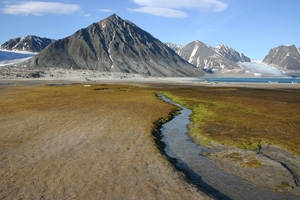 Further in, off the beach, there is a field with moss tundra (green and brown) and thin sand vegetation (light brown, in front on the left). These types of vegetation are very vulnerable to traffic. Do not walk here. (Image: Bjørn Fossli Johansen / The Norwegian Polar Institute) Further in, off the beach, there is a field with moss tundra (green and brown) and thin sand vegetation (light brown, in front on the left). These types of vegetation are very vulnerable to traffic. Do not walk here. (Image: Bjørn Fossli Johansen / The Norwegian Polar Institute)
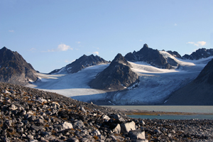 Towards Gullybreen. (Image: Bjørn Fossli Johansen / The Norwegian Polar Institute) Towards Gullybreen. (Image: Bjørn Fossli Johansen / The Norwegian Polar Institute)
Gravneset in Magdalenefjorden – whaling station and cemetery
"But there was nothing written of who they were, where they came from and when they died"
(Léonie d'Aunet)
According to historical sources, Magdalenefjorden was first used by the English in the early days of the whaling era. They erected a land station on the headland and named the area Trinity Harbour. The station was closed in 1623, but the cemetery remained in use. The dead were traditionally buried on dry land, and the cemetery on Gravneset eventually became a large one.
Literary sources tell us that Gravneset was visited by tourists as early as the 1800s. The French traveller Léonie d'Aunet gave the place its name when she visited it in 1838. Through her stories we can make out a vivid picture of the cemetery and the gloomy scenery, strewn with whale and walrus bones, like eerie, white remains of enormous extinct species in a far away land. In the cemetery she found that several of the coffins had made their way through the snow, heaved up to the surface by the permafrost, half open and empty on account of polar bears. Other coffins remain untouched, covered in rocks. D'Aunet wondered who had been laid to rest here, and who were buried in "coffins without headstones, without monuments, without wreaths or flowers, without anyone to cry or pray for them, without a friend to miss them, and visit their barren, frozen place of rest, where the wild howls of the polar bears and the storms are the only things to break the deep silence" (En pariserinnes reise gjennom Norge til Spitsbergen anno 1838, 1968).
Through the course of Svalbard's history, few places have been as frequently visited as Gravneset, and it remains one of the most popular sites of cultural heritage in Svalbard. As early as 1932 Mining Inspector Mercoll said in an interview with the newspaper Aftenposten that tourists had ravaged so much of the cemetery that in 1930 they had to re-bury a large amount of bones. In 1979 Gravneset was said to look more like a campsite than a cemetery. The graves have been opened by curious tourists and remains of bones have been taken home as souvenirs. Ships’ names and other graffiti have been painted on the rocks of the grave area. Bonfires have also been lit among the graves, and remains of wood have been removed from the coffins. People have trampled on graves where coffin boards and skeletons have been exposed.
Vulnerable elementsToday Gravneset has visible damage from traffic in the form of pronounced paths and areas where the vegetation has been worn away. To protect them from further wear and tear, the areas around the graves and the blubber ovens were fenced off in 2002.
Walking inside the fence is not permitted. Landing sitesThe most popular landing site is the sandy beach on the eastern part of Gravneset. The beach further in is shallower and not well suited for landing. It is also possible to land in the pebble bay west of Gravneset. This landing site is more exposed to waves. Recommended trailsThere is a path to Gullybreen from Gravneset. Parts of the way the path has been cleared of stones.
|